Till - Tweed Project
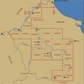

Region: North East
Owner Type: Mixed
Funding Body: ALSF
Year of Intervention: 2002 - 2003
Summary: The Till-Tweed project has examined a large, archaeologically sensitive landscape to produce detailed archaeological and geomorphological maps together with a guidance document for use by planners, consultants, developers and researchers. Public outreach and educational initiatives formed an important part of this project.
To build a more effective environment for decision-making it was decided that:
- an up to date assessment of the archaeological resource was required
- the information should be integrated into a single GIS which could be distributed free of charge to planners, consultants, developers and researchers
- an explicit tabulation of the decision-making process and archaeological evaluation be included in the guidance document to provide transparency and consistency
- using the geomorhpological landform element mapping the most appropriate techniques for evaluating sites on a given landform could be identified in advance
This case study has been effective in highlighting various elements of good practice:
- importance of consultation and getting to grip with, and understanding the various perspectives and needs of the potential users and stakeholder groups
- create forums for interaction (seminars, launches, social events and community events) where users can be steadily built
- high quality mapped data supported by comprehensive archaeological and geomorphological data provides explicit baseline data from which logical and reasoned decision –making can take place - thereby making decision-making easier, more explicit and consistent.
Hard copies of the Planning for the Future: Guidance for Managing the Archaeological and Palaeoenvironmental Resource in the Till-Tweed Valleys, Northumberland, UK document are available by . The PDF version of the document is now available to download from the PDF version section of this web page.
Keywords: ASSESSMENT AND CHARACTERISATION, EDUCATION AND OUTREACH, DISPLAY AND INTERPRETATION, SOCIAL INCLUSION AND ACCESS, MANAGEMENT PLANS, PUBLICATION